Steven Sparks | Backwoods Land Co.

Powered By EmbedPress

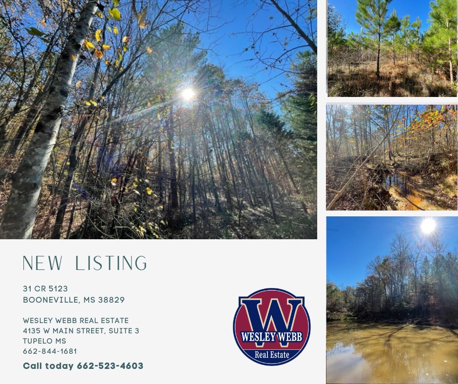
This 294 acre tract in Alcorn County, MS is a turnkey hunting and timber tract. Located just 3 miles from the Tuscumbia River, this tract benefits from its proximity to the surrounding wetlands, which are known to be a key stopover along the Mississippi Flyway. While primarily suited for deer hunting, the fertile creek bottoms in the low lying wetland areas of the property may also create suitable conditions for attracting waterfowl during migration seasons. Walnut is also well known from prime turkey hunting. The combination of varied terrain and water access enhances the tracts hunting versatility.
The natural ridges, valleys, and gentle slopes create ideal movement corridors for deer. These natural features form good pinch points, while multiple cleared areas would make ideal food plots. A 672 sq. ft. manufactured home, featuring 2 bedrooms and 1 bathroom, serves as a convenient hunting camp with power and water. Additionally, power and water and fiber are available at the road (County Road 762), with multiple prime spots along the road.
In addition, this tract features a rich stand of bottomland hardwoods, shortleaf, and loblolly pines. The combination of wildlife and timber make this property valuable in more ways than one.
Conveniently located within easy driving distance to Ripley (18 miles), Corinth (30 miles), Tupelo (50 miles), and Memphis (70 miles), this property offers the perfect blend of outdoor recreation and accessibility.
 
🦌 Prime deer and turkey hunting
🦆 Potential waterfowl opportunities due to lowlying wetland bottoms portion and proximity the Mississippi Flyway
🌲 Rich timber resources: bottomland hardwoods, shortleaf, and loblolly pines
🏠 672 sq. ft. hunting camp with power and water
🔌 Utilities (power, water, fiber) available at the road
📍 Multiple building sites
🏫 Located in the Alcorn County School District
🚗 Easy access to Ripley, Corinth and Tupelo
 
☎️ Steven Sparks 662-523-4503
☎️ Office: 601-209-4882
Facebook
Twitter
LinkedIn

Powered By EmbedPress

agriculture

Land for Sale | CR 47 New Albany, Mississippi

Powered By EmbedPress

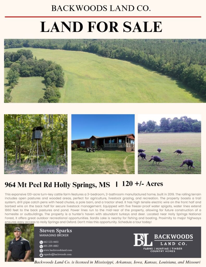
This expansive 120 acre turn-key cattle farm on Mt Peel Rd in Holly Springs, MS features a 3-bedroom, 2-bathroom manufactured home, built in 2019. The rolling terrain features a blend of open pastures and wooded areas including old hardwoods and some pine, ideal for agriculture, livestock grazing, and recreational activities.
The property also boasts a well-maintained trail system, drill pipe catch pens with head chutes, a pole barn, pond and a tractor shed. This tract includes high tensile electric 12.5 gauge steel wire on the front half and barbed wire on the back half, ensuring secure and efficient livestock management. The land is equipped with five freeze-proof water spigots, with water lines extending 1860 feet to the back pastures and stocked pond. Additionally, power lines run to the mid-rear of the property, providing flexibility for future construction of a homesite or outbuildings.
This property is also hunter’s haven with an abundance of turkeys and deer. Holly Springs is well known for its excellent turkey hunting.
Located near Holly Springs National Forest, this area offers excellent outdoor recreational opportunities. Sardis Lake, another popular destination for fishing and boating, is also within about 5 miles
.
Proximity to major highways, including MS Highway 4 and US Highway 78, ensures easy access to nearby towns such as Holly Springs and Oxford. Don’t miss out on this unique opportunity. Schedule a tour today!
Key Features
🏡 3-bedroom, 2-bathroom manufactured home
🌳 120-acre property with rolling terrain
🦃 Abundant wildlife, including turkeys and deer
🔌 High tensile electric 12.5 gauge steel wire on the front half and barbed wire on the back half
🚰 Five freeze-proof water spigots
🚿 Water lines extending 1860 feet to the back pastures
⚡ Power lines running to the mid-rear of the property
🚜 Drill pipe catch pens with head chutes
🏚️ Pole barn and tractor shed
🛤️ Well-maintained trail system
🌲 Close to Sardis Lake and Holly Springs National Forest
🚤 Convenient distance to Sardis Lake
🛣️ Easy access to MS Highway 4 and US Highway 78
🏙️ Near towns of Holly Springs and Oxford
🌱 Vicksburg Silt Loam (Va) Soil:
🧺 Acres: 52.24
📏 Percentage of Total Area: 43.09%
🌾 NCCPI (National Commodity Crop Productivity Index): 90
🥇 Capability Class (CAP): 1
📜 Description: Vicksburg silt loam is a highly productive soil type suitable for various agricultural activities. Its high NCCPI score indicates excellent productivity potential for crops.

Powered By EmbedPress

Land for Sale | CR 47 New Albany, Mississippi Read More »

Von Thünen’s Model – A Historical Lens on Modern Agriculture and Real Estate Analysis

Facebook
Twitter
LinkedIn


            Von Thünen’s Model and its Usefulness in Real Estate Analysis


Picture this: a long time ago in Germany, there was a farmer and economist named Johann Heinrich Von Thünen. He lived in a time when farming was rapidly. People were moving away from old-style farming and starting to sell their products in markets. Von Thünen was curious about how farmers could make the most money by using their land wisely.

Von Thünen’s model, developed by the German economist Johann Heinrich von Thünen in the early 19th century, is a seminal concept in the field of agricultural and land use economics. While originally designed to explain agricultural land use patterns, this model has found applications in various disciplines, including real estate appraisal. This article explores how Von Thünen’s model can be useful in the context of real estate appraisal and other modern analysis concepts of land use.

                                            Understanding Von Thünen’s Model


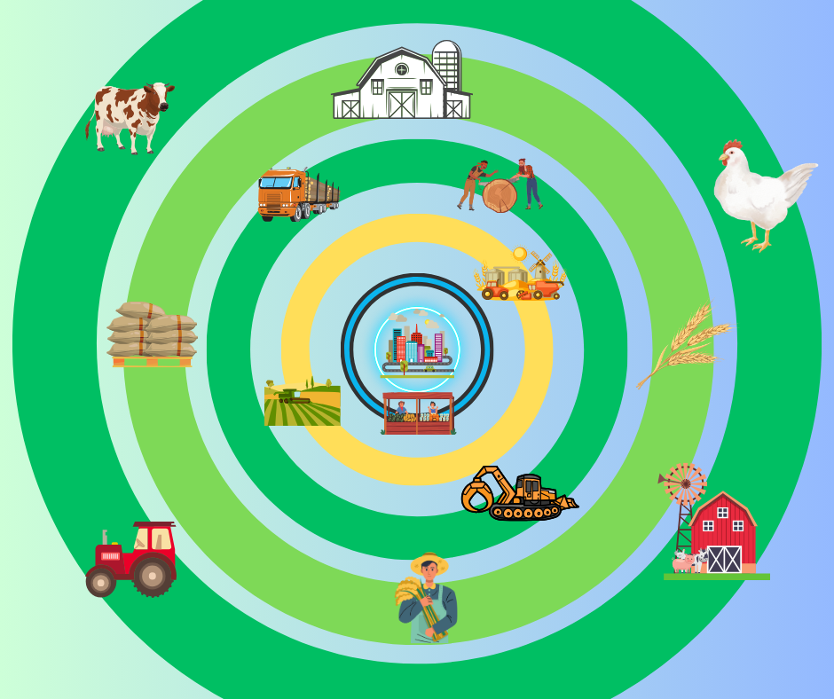
Von Thünen’s model revolves around the concept of land use and spatial distribution based on transportation costs. The central premise is that land use decisions are primarily influenced by proximity to markets and the cost of transportation. In his model, Von Thünen envisioned a hypothetical isolated city surrounded by a circular region of agricultural land, where different types of crops and land uses are arranged concentrically based on transportation costs.

                                                               The Isolated City

Von Thünen’s model starts with the assumption of a central city or market, which serves as the focal point for economic activity.    

                                                                 Land Use Zones


Land uses are organized in concentric rings around the central city. The specific type of crop or land use in each ring is determined by the cost of transportation to the city. The most profitable crops or land uses are located closest to the city, while less profitable ones are placed farther away. Think of this place as having rings around the city, like the rings on a bullseye. Each ring is for different types of farming, like growing crops or raising animals.

Transportation Costs Transportation costs increase with distance from the city. This cost gradient is crucial in determining which crops or land uses are economically viable at different distances from the city. If you’re close to the city, it’s easier to sell your stuff, so you might grow things that need more care. But if you’re far away, you might grow things that don’t need as much attention.

                                          Real Estate Appraisal and Von Thünen’s Model


Real estate appraisal involves determining the value of a property based on various factors, including its location, land use, and market demand. Von Thünen’s model can be applied to real estate appraisal in several ways:

Von Thünen’s model provides a framework for understanding how proximity to a central market affects property values. Real estate appraisers can use this concept to assess the desirability of a location and its potential for future development. Properties are historically located closer to major economic centers are often more valuable due to easier access to services and markets. However, Over the years, urban areas have experienced exponential population growth, leading to urban sprawl and the expansion of metropolitan regions. As cities expand outward, the dynamics of location desirability become more complex. Peripheral areas, once considered less valuable due to their distance from the central market, may now gain prominence as urban boundaries expand. This expansion, driven by factors like housing demand and infrastructure development, challenges the traditional application of Von Thünen’s model.

Another critical factor reshaping location analysis is the prevalence of crime and safety concerns. In many cases, areas closer to central markets have experienced higher crime rates, prompting potential residents and businesses to seek safer, albeit more distant, alternatives. This shift can lead to a reevaluation of property values, with safety considerations outweighing proximity to the central market

                                                          Land Use Planning


Real estate appraisers can consider the historical and predicted land use patterns in an area based on Von Thünen’s model. This can help in evaluating the potential demand for various types of properties. For example, if a region is transitioning from agriculture to residential development, understanding this shift can inform property appraisals.

                                                   Transportation Infrastructure


The cost of transportation plays a critical role in property values. Proximity to highways, public transportation, and other infrastructure can significantly impact property appraisals. Von Thünen’s model underscores the importance of considering transportation costs when appraising real estate.

                                                               Market Analysis


Real estate appraisers can analyze the accessibility of properties to different markets using the Von Thünen framework. This analysis can help in estimating the potential rental or sale value of a property, as properties closer to lucrative markets tend to command higher prices keeping shifting demands in mind.

                                                     Rural and Agricultural Land


In rural areas, the model can be used to assess the value of agricultural land based on its proximity to markets and the type of crops or land use in practice. This can guide decisions related to land purchase, leasing, or conversion.

                                                Geographic Information Systems


Geographic Information Systems (GIS) technology is a powerful tool for real estate analysis, allowing professionals to integrate spatial data into their decision-making processes. Von Thünen’s model can be applied within a GIS framework to assess real estate values and land use patterns. Here’s an example of how to use this model for GIS-based real estate analysis:

Scenario: Imagine you are a real estate developer interested in acquiring land for a new residential project in a suburban area near a major city. You want to use GIS to determine the most suitable location for your development based on Von Thünen’s model.

Step 1: Data Collection

Market Data: Obtain data on the central city’s economic activities, employment centers, and population growth projections. This can be collected from government sources, economic development agencies, and census data.

Transportation Infrastructure: Gather GIS data on existing transportation infrastructure, including highways, major roads, public transit routes, and airports. You can access this data from local transportation departments or open data sources.

Land Use Data: Acquire land use data for the study area. This data should include information on existing residential, commercial, agricultural, and industrial land uses.

Step 2: GIS Analysis

Market Proximity: Use GIS to create a buffer zone around the central city, with varying distances representing the zones in Von Thünen’s model. For example, you might have concentric buffers at 5 miles, 10 miles, 15 miles, and so on.

Transportation Costs: Calculate transportation costs or travel times from each point within these buffer zones to the central city using GIS network analysis tools. Consider factors like road quality, traffic congestion, and public transit availability in your cost calculations.

Land Use Overlay: Overlay the land use data onto the buffer zones. This will help you determine the predominant land use types within each zone.

Step 3: Analysis and Decision-Making

Market Demand: Analyze the market data to understand the current and future demand for residential properties in the central city and its surrounding areas.

Transportation Costs: Assess the transportation costs or travel times for each buffer zone. Consider the model’s principle that transportation costs increase with distance from the central city.

Land Use Suitability: Evaluate the suitability of land use within each buffer zone based on the model’s principles. For instance, if the model suggests that agriculture is more viable in the outer zones, but market demand is for residential properties, you may prioritize zones with a mix of agriculture and residential land.

Value Assessment: Combine the information on market demand, transportation costs, and land use suitability to estimate the potential value of properties within each buffer zone. Properties that align with market demand and have reasonable transportation costs are likely to be more valuable.

Location Selection: Based on the analysis, identify the buffer zone that offers the best balance between market demand, transportation costs, and land use suitability. This zone is likely to be the most suitable location for your residential development project.

By applying Von Thünen’s model within a GIS framework, you can make data-driven decisions in real estate development. GIS allows you to visualize and analyze complex spatial relationships, helping you identify the optimal location for your project while considering market dynamics and transportation factors.

                 Outlying Rural Development: Changes Since Von Thünen’s Model


Johann Heinrich von Thünen’s model, developed in the early 19th century, provided valuable insights into agricultural land use patterns based on transportation costs and proximity to urban centers. While his model remains relevant for understanding certain aspects of rural development, the world has undergone significant changes since his time. Here are some key ways in which outlying rural development has evolved since Von Thünen’s model was first introduced:

                                                Technological Advancements


One of the most significant changes is the advent of modern transportation and communication technologies. The widespread availability of automobiles, improved road networks, and the rise of the internet have reduced the relative importance of transportation costs in land use decisions. As a result, rural areas are no longer as constrained by distance from urban centers, and economic activities can be more dispersed.

                                             Urbanization and Suburbanization

The continued trend of urbanization and suburbanization has reshaped the rural landscape. Many rural areas have experienced population decline as people migrate to urban and suburban areas in search of better economic opportunities and amenities. This has led to changes in land use, with some rural regions becoming more residential or recreational in nature.

                                              Diversification of Rural Economies

Rural economies have diversified beyond traditional agriculture. While agriculture remains important, rural areas now host a variety of industries, including manufacturing, technology, tourism, and renewable energy production. These new economic activities have transformed the rural development landscape, with different land use patterns emerging.

                                  Land Conservation and Environmental Concerns

Environmental and conservation concerns have led to changes in land use practices in rural areas. Government regulations and incentives often encourage the preservation of open space, the protection of natural habitats, and sustainable land management. This has influenced the way rural land is used and developed.

                                                    Amenity-Based Development


Some rural areas have transitioned to amenity-based development, attracting residents and businesses due to their natural beauty, recreational opportunities, and quality of life. This form of development is less tied to traditional agricultural or industrial land use patterns and is driven by lifestyle choices.

                                                                  Globalization


Globalization has increased the interconnectedness of rural areas with the broader world economy. Rural regions now participate in global supply chains, leading to changes in land use to accommodate export-oriented agriculture and manufacturing.

                                                        Infrastructure Investments


Public and private investments in rural infrastructure, such as airports, railroads, and broadband internet, have opened up new possibilities for rural development. These investments have improved connectivity and accessibility, reducing the isolation often associated with outlying rural areas.

                                                     Cultural and Demographic Shifts


Changes in demographics, with an aging population and an influx of younger generations with different preferences and lifestyles, have influenced rural development. These shifts have led to changes in housing preferences and the demand for services in rural areas.

                                                                     In Summary

I have firsthand experience with Geographic Information Systems (GIS) and have noted similar patterns to Von Thünen’s model. However, the global landscape is evolving at an unprecedented pace, and although this model remains effective, it is continually adapting to the ever-changing dynamics of our world.

While Von Thünen’s model laid a foundational framework for understanding rural land use, the landscape of outlying rural development has evolved significantly since its conception. Modern factors like technological advancements, urbanization, economic diversification, environmental concerns, and globalization have all contributed to a more complex and diverse rural development pattern. These changes highlight the need for a more comprehensive and nuanced approach to understanding and planning for rural development in the 21st century.

Von Thünen’s Model – A Historical Lens on Modern Agriculture and Real Estate Analysis Read More »

Sow Kudzu, Sow Prosperity | History and Impact of Kudzu Cultivation

The Champion of the Kudzu Cause: Channing Cope

Enter the story of Channing Cope. Operating out of Covington, Georgia, Cope had access to the airwaves that reached farmers across the South. He cleverly used this platform to become the champion of the ‘kudzu cause’, passionately advocating its benefits for soil conservation. Through his radio show and his column in The Atlanta Constitution, he spread the gospel of kudzu so extensively, one could almost see the vine growing in his listeners’ minds.

The Journey of Kudzu: From Panacea to Nemesis

The journey of kudzu began in 1876 when it was imported from Japan for the Philadelphia Centennial Exposition. Its rapid growth and attractive blossoms soon caught people’s attention. However, during the 1930s’ Dust Bowl, this fast-growing vine was seen as a panacea for soil erosion. The U.S. Soil Erosion Service even endorsed the widespread planting of kudzu. Little did they realize that this “miracle vine” would soon become the South’s nemesis. Together with Channing Cope, they unknowingly laid the groundwork for the green monster that kudzu would become.

The Kudzu Club of America and the Growth of a Green Monster

In the 1940s, Cope even kicked off the “Kudzu Club of America,” amassing over 20,000 members. The club’s motto was as simple: “Sow kudzu, sow prosperity.” It was the perfect jingle for the times, dovetailing with the U.S. government’s promotion of kudzu. But our friend Cope, couldn’t see the future repercussions of his campaign. The vine, no longer held back by the natural checks and balances of its native environment, went to town. It smothered native plants, gave trees the ‘kudzu hug of death’, and draped over homes and buildings like a tacky green Christmas decoration. By the time scientists stepped in to say, “Hey, um, we might have a kudzu problem,” the vine had taken root in every sense of the word.

The Lessons from Kudzu: Consider the Consequences

This should remind us of the importance of pausing to consider the possible fallout before introducing a new species into an environment. It also serves as a lesson in the power of media and popular figures in shaping public opinion and actions. Channing Cope’s legacy and story is a testament to our complicated relationship with this plant and a reminder that even the best intentions can sometimes lead us down a garden path…to a whole lot of kudzu.

Kudzu: An Emblem of Southern Grit and Adaptability

Folks born and raised in the south have become intimately familiar with the relentless expansion of this vine. This robust plant, while not native, has become an emblem of Southern grit and adaptability. It’s etched itself into our narrative and is part of our story. Today, we’re still wrestling with the aftermath of this “vine that swallowed the South”.

Applying Herbicides: Techniques and Timing

One method to control kudzu is through chemical intervention. Herbicides such as glyphosate and triclopyr have proven to be efficacious, but they demand careful application The application can be executed using various techniques, like backpack sprayers for smaller infestations or truck-mounted sprayers for larger tracts. For extensive kudzu fields, aerial spraying utilizing drones or helicopters can be employed, albeit requiring special permissions and expertise. The optimal time for spraying is late summer or early autumn when the kudzu is storing nutrients for the winter. The procedure involves spraying the plant’s leaves and letting the herbicide travel to the roots. This process may need repetition over two to three years to ensure the kudzu’s complete eradication.

Prescribed Burning: An Effective Tandem Method

Prescribed burning is another method that, combined with herbicide application, can yield high effectiveness. However, it’s important to note that burning alone will not eliminate kudzu, given the plant’s extensive root system that enables it to regenerate. Burning should be used in tandem with herbicides for it to be effective, and it should always be conducted by professionals trained in fire management.

Herbicides and Burning: A Strategic Combination

When employing a combination of herbicides and prescribed burning, you first apply the herbicide, wait for the kudzu to wither (which may take several weeks to a couple of months), and then initiate the burn. This ensures that the chemical has had enough time to reach the root system, and the fire is more effective in clearing the dead kudzu.

Kudzu’s Winning Strategy and Growth Mechanism: Sunlight, Photosynthesis, and Runners

Kudzu doesn’t strangle its plant rivals. No, it’s more subtle. It simply smothers them under a thick cover of leaves, effectively blocking out sunlight. Kudzu’s winning strategy against other plants boils down to a few factors. Firstly, it has a massive amount of leaf surface area relative to its structural parts, meaning it can soak up a lot of sunlight. Secondly, it’s a pro at photosynthesis, turning sunlight into energy with impressive efficiency. Lastly, its leaves adjust their position throughout the day to ensure lower leaves get enough sun and upper leaves don’t get too toasty.

Spreading kudzu seeds isn’t its style. Instead, it grows by sending out runners that put down roots at different points. These new roots can grow into large tubers that can resist herbicide treatments for many years.

The Financial Impact of Kudzu: A Nightmare for Industry

Financially, kudzu is a nightmare. It reduces the worth and quantity of timber. Currently, kudzu blankets over seven million acres across the U.S. and is expanding at a rate of about 120,000 acres annually. U.S. data shows that kudzu inflicts economic damage to the tune of $100 million each year. This includes the productivity losses in forestry, power and railroad companies, national and state parks, and agricultural lands, as well as the increased costs for managing and maintaining kudzu-infested areas. Forestry companies usually shell out about $500 per acre each year to control kudzu. Power companies fork over around $1.5 million per year to manage kudzu issues and offset power loss.

Cost of Kudzu Extermination: A Pricey Battle

Now, onto the cost of kudzu extermination. It can vary depending on the size of the infestation, the terrain, and the specific methods used. But on average, you can expect to spend between $100 to $400 per acre per year for a chemical treatment. This sum includes the cost of the herbicides and the labor to apply them. Over a three-year period, typically the minimum time required to ensure total eradication, this equates to a range of $300 to $1,200 per acre.


The Cost of Prescribed Burns: An Additional Expense

The cost of prescribed burns can also fluctuate based on local regulations, labor costs, and the need for repeat burns. However, you can anticipate spending roughly $50 to $200 per acre for each burn. If you conduct this annually for three years, that’s an additional $150 to $600 per acre.

The Kudzu Story: A Cautionary Tale

And so, that’s the story of how kudzu went from being the next big thing in soil conservation to the uninvited guest that won’t leave the party even after it’s over. It’s a classic tale of “be careful what you wish for.” We wanted a quick fix for soil erosion, and boy, did we get it.

Links and Resources: Learning More about Kudzu

  1. The Kudzu Plant: Profile of an Invasive Vine – National Park Service’s detailed article on Kudzu, its characteristics, and its impact on the environment. http://www.nps.gov/articles/kudzu.htm
  2. Invasive Species: Kudzu – Information about Kudzu from the U.S. government’s National Invasive Species Information Center. http://www.invasivespeciesinfo.gov/profile/kudzu
  3. The Economic Impact of Kudzu – An academic study on the economic consequences of Kudzu infestation, available through JSTOR. http://www.jstor.org/stable/10.2307/12345678
  4. Methods for Controlling Kudzu – USDA Forest Service’s guide on various methods for controlling and eradicating Kudzu. http://www.fs.fed.us/research/invasive-species/plants/kudzu.php
  5. Kudzu in Georgia: History, Uses, and Control – A comprehensive resource from the University of Georgia Extension detailing the history of Kudzu in Georgia and methods for its control.

Sow Kudzu, Sow Prosperity | History and Impact of Kudzu Cultivation Read More »

The Watershed Warrior

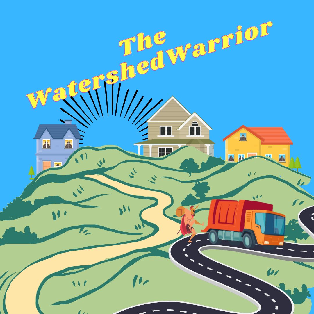
As Bill Billsbilly, patrolled his beloved watershed around his neighborhood, he knew that his enemies were always lurking nearby. Garbage trucks, with their noxious fumes and potential for littering, were his greatest foes.

So, whenever he heard the rumble of a garbage truck approaching, Bill would grab his trusty spear and don his warpaint. He would leap into action, charging towards the truck and shouting at the top of his lungs.

“Back away from my watershed, you scoundrels!” he would yell.

The garbage truck drivers would usually speed away, scared off by the wild and fierce looking man with war paint charging toward them. But if they were foolish enough to stick around, Bill was always ready to defend the watershed with all his might.

One time, a particularly stubborn garbage truck driver refused to leave, insisting that he had a job to do and couldn’t just abandon his route. Bill was having none of it. He marched right up to the truck, spear in hand, and began banging on the side with all his might.

“Get out of here, you dirty trash-mobile!” he shouted.

The driver, clearly confused and frightened by the wild man with the spear, finally relented and drove away. Bill stood like a boss, watching as the garbage truck disappeared down the road.

From that day forward, Bill became known as the ultimate defender of the watershed. People in the community would wave and cheer whenever they saw him, grateful for all the hard work he did to keep their water clean and pure despite the neighborhood smelling like pure garbage.

And whenever a garbage truck dared to drive by, they knew better than to mess with the “Watershed Warrior.”

Bill had other talents besides chasing garbage trucks, he could also pick a tune. He formed a band called the Watershed Warriors after his nickname of course. One their songs, “Manage the Land Use Dummy ,” quickly became a hit with audiences across the country.

As the band gained popularity, soon, their song hit number one on the charts, and the Watershed Warriors became a household name. The End.


WHAT IS A WATERSHED EXACTLY?


Think of a watershed like a giant bathtub that collects rainwater and snowmelt from surrounding mountains and hills. Just like in a bathtub, the water flows down to the drain, which in this case is a river or a stream.  Before it reaches the drain, the water runs over and through the ground, picking up sediment and pollutants along the way. This can include fertilizers, pesticides, and even trash from garbage trucks as Bill would have it.

That’s why it’s important to take care of watersheds. We can protect them by using natural filters like trees and plants, which can trap pollutants and reduce sediment runoff. We can also prevent soil erosion and minimize pollution from urbanization, agriculture, and other human stuff. When we protect watersheds, we not only preserve the health of our environment and the habitats of wildlife, but we also ensure that we have clean and safe water for our daily needs. Healthy watersheds can also have a positive impact on property values, as people are more likely to want to live in areas with access to clean water and natural beauty. Would you pay a premium for it?

It catches rainfall and snowmelt, then channels it into creeks, streams, and rivers, ultimately leading to a larger body of water, such as a lake or ocean even. Yes, Watersheds can vary in size greatly, ranging from small, localized areas to large regions that span multiple states or even countries. However large or small from the Mighty Mississippi to a pond on your hunting land, they are started small.

If a town is located within the boundaries of a watershed, it is possible for the watershed to supply the town with all the water it needs. This is because the water that falls within the watershed is collected and treated to make it safe for human consumption. Therefore, it’s important to protect the quality of the water within the watershed to ensure that it remains safe to drink.

A watershed encompasses all the land, vegetation, and water resources that are found within its boundaries. This includes forests, fields, wetlands, and rivers. The health of a watershed depends on the balance of all these things. Trees and plants help absorb and filter rainfall, preventing soil erosion and sedimentation of the waterways. Wetlands are like sponges, absorbing water and slowly releasing it into the surrounding environment, thereby preventing flooding downstream.

It is important to take care of watersheds because they provide many benefits to communities, including clean water for drinking, recreation, and irrigation. In addition, watersheds help support healthy ecosystems by providing habitat for wildlife and supporting biodiversity. On the other hand, degradation of a watershed can lead to erosion, pollution, and a loss of habitat, which can impact the health of the entire ecosystem.

WATERSHED VS CATCHMENT BASIN


A watershed and a catchment basin are similar in that they both refer to an area of land where all the water that falls within its boundaries flows to a common outlet, such as a lake, river, or ocean. However, a watershed is typically larger in scale than a catchment basin and encompasses all the land that drains to a common outlet, including hills, mountains, and valleys. A catchment basin, on the other hand, refers specifically to the area of land where water collects before flowing into a larger body of water.

Both watersheds and catchment basins are important because they provide a source of freshwater for drinking, irrigation, and industrial use. They also provide a habitat for various plants and animals, which in turn supports the food chain.

When PESTICIDES AND OTHER CHEMICALS these substances are applied to crops or spilled onto the ground, they can be carried by rainwater and runoff into streams and rivers, causing harm to aquatic life and making the water unsafe for drinking or recreational use.

When trees are cut down or land is paved over, there are fewer plants to absorb and filter rainwater. This can lead to increased erosion and sedimentation in streams and rivers, which can harm aquatic life and cause flooding.

DAMS IN RELATION TO WATERSHEDS


Dams can have both positive and negative impacts on the surrounding watershed. On one hand, they can provide a reliable source of water for drinking, irrigation, and other uses. On the other hand, they can disrupt the natural flow of water, affecting downstream ecosystems and wildlife.


PROPERTY VALUES IN RELATION TO WATERSHEDS


Real lie example : In the city of Atlanta, Georgia, the Chattahoochee River watershed has been a significant factor in property values.

Properties located near the Chattahoochee River, which serves as a source of drinking water for the city, are highly sought after due to the recreational opportunities and natural beauty provided by the river. According to a study conducted by the Trust for Public Land, properties located within a half-mile of the river are worth an average of 43% more than properties located farther away.

Furthermore, properties located in areas with healthy watersheds tend to be more valuable than those in areas with degraded watersheds. In the case of the Chattahoochee River, efforts to improve water quality and preserve the watershed have led to an increase in property values over time.

Overall, the health of a watershed can have a significant impact on property values in the surrounding area. As a result, protecting and preserving watersheds can have both ecological and economic benefits for communities.

As a result of the preservation efforts, the Ruffner Mountain Nature Preserve has become a popular destination for outdoor recreation and education. Additionally, the protected watershed has helped to maintain the quality of the Cahaba River’s water, which has been a selling point for nearby properties. In fact, according to a study conducted by the Trust for Public Land, the nature preserve has contributed to a $6.9 million increase in property values for homes located within a half-mile of the preserve.

Another example of how watersheds can affect property values is the Chesapeake Bay watershed in Maryland, Virginia, and Pennsylvania. The Chesapeake Bay is the largest estuary in the United States, covering an area of over 64,000 square miles, and is fed by over 150 rivers and streams. The watershed is home to over 18 million people and is a vital source of drinking water, recreation, and economic activity.

In recent years, the health of the Chesapeake Bay has been threatened by pollution from agricultural runoff, urban development, and other sources. Efforts have been made to restore the health of the Bay through initiatives such as the Chesapeake Bay Watershed Agreement, which aims to reduce pollution and restore habitat.

The health of the Chesapeake Bay and its watershed can have a significant impact on property values in the region. A study by the Chesapeake Bay Foundation found that properties located within 1,000 feet of the Bay and its tributaries had an average value that was 38% higher than similar properties located farther away. This suggests that proximity to a healthy and vibrant watershed can be a significant factor in property values. On the other hand, properties located near areas of the Bay and its tributaries that are experiencing water quality problems may see a decline in value.


Here are some online resources and links related to watersheds and property values:

“The Impact of Watershed Conditions on Property Values” – a research paper by the US Forest Service: https://www.fs.fed.us/pnw/pubs/journals/pnw_2012_kovacs001.pdf

“The Relationship between Water Quality and Property Values: A Review of the Literature” – a report by the Environmental Protection Agency: https://www.epa.gov/sites/default/files/2015-10/documents/relationship_between_water_quality_and_property_values.pdf

“Watershed Services and Property Values” – an article by the American Geosciences Institute: https://www.americangeosciences.org/critical-issues/research-database/docs/watershed-services-and-property-values

“The Value of Watersheds” – a report by the World Wildlife Fund: https://www.worldwildlife.org/publications/the-value-of-watersheds

“Watershed Property Values: A Case Study of the Jordan Lake Watershed in North Carolina” – a research paper by Duke University: https://dukespace.lib.duke.edu/dspace/handle/10161/4829

These resources provide valuable information on the relationship between watersheds and property values. They analyze the impact of watershed conditions, water quality, and other factors on property values, providing useful insights for homeowners, policymakers, and other stakeholders.

The Watershed Warrior Read More »

Price Reduced! $64,000

Price Reduced! $64,000 Read More »

Wild Hogs: A Growing Threat to Southern US Farms

It was a hot summer day in the heart of the South, and I, George, was in a predicament. My farm, sprawling over 300 acres of fertile land, had become overrun by a horde of wild hogs, those damnable beasts that had the audacity to ravage my crops, disrupt my fields, and steal eggs from my chickens.

I had tried every method in the book to rid my land of these pigs – fences, traps, hunting, you name it – but nothing seemed to work. I was at my wit’s end, feeling defeated and wondering how I was going to save my farm.

But then, one fateful night, everything changed. I was sitting on my porch, nursing a bottle of bourbon, when I heard a commotion coming from my barn. I stumbled over, curious as to what the was going on, and was greeted with a sight that I would never forget.

A whole herd of wild hogs had moved into my barn, and they were acting like they owned the place. They had set up beds and a small kitchen area, for Christ’s sake. I couldn’t help but laugh at the absurdity of it all.

I decided what the heck, if you can’t beat em, join em.

He fired up the grill and cooked up a feast fit for a king! The aroma of the grilled corn and sweet potatoes wafted through the air, and the hogs could hardly contain themselves. They gathered around George, oinking and snuffling in excitement, as he served up the delicious meal.

The hogs devoured the food, their eyes rolling back in pleasure as they savored the taste of the succulent pork and the sweetness of the sweet potatoes. George couldn’t help but smile, feeling a sense of satisfaction that he had been able to give these wild animals a good meal.

I went back inside. The hogs were in hog heaven and we all sat down to enjoy a feast fit for a king.

From that day on, my farm was a haven for wild hogs, and we lived in a strange harmony. They helped themselves to my crops, but in return, they helped me by keeping pests away and protecting my chickens from other predators. My farm prospered and I was never short of bacon and pork chops.

NOW, BACK TO REALITY


I George, with promise of a bountiful harvest, I ventured deeper into the heart of these farmlands, I began to see the telltale signs of destruction. Ragged holes in the ground, torn up plants and crops, and the unmistakable tracks of wild hogs.

These feral beasts, once domesticated and raised for food, have now run wild, wreaking havoc on the farms and livelihoods of hardworking Americans. They root through fields, devouring crops and destroying the soil, leaving behind a trail of devastation in their wake.

Farmers and ranchers, already struggling to make a living, now have to contend with this added threat to their livelihood. They spend countless hours and resources trying to keep these hogs at bay, from building fences to hiring hunters to thin the population.

But even with these efforts, the damage continues to mount. The hogs are relentless in their pursuit of food, and they are spreading across the country at an alarming rate. They are now found in nearly every state, causing over a billion dollars in damages to crops and property each year. According to a USDA study, wild hogs can be blamed for $1.5 billion in damages every year in the United States.

It is estimated that 75 percent of a hog population must be killed each year in order to maintain a static population.


As I watched the farmers and ranchers go about their work, I couldn’t help but feel a sense of sadness and frustration. These men and women, who had devoted their lives to the land, were now fighting an uphill battle against a force they couldn’t control. The wild hogs were a constant reminder of the fragility of the American farming industry and the resilience of those who work it.

It is a problem that demands attention and action. The wild hog population needs to be controlled before it causes even more damage to the crops and farms of this great nation. The future of American agriculture depends on it.

But the damage caused by wild hogs is not limited to crops and farmlands. These animals also prey on other species, decimating their populations. They have been known to eat a wide variety of animals, including deer, turkey, ground-nesting birds, and even small mammals such as squirrels and raccoons.

In addition to the ecological impact, this also poses a significant threat to the hunting and fishing industries, which rely on healthy populations of native species to sustain their businesses. The wild hog problem is not only an agricultural issue, but a conservation one as well.

The wild hog population must be controlled to protect the crops, farms, ecosystems, hunting, and fishing industries and to preserve the natural heritage of the United States.

The wild hog problem is not only an agricultural issue, but a conservation one as well. These voracious animals have been known to prey on other native species, decimating their populations and disrupting the delicate balance of ecosystems. Wild hogs have been identified as a significant threat to many species of animals. In some cases, their predation has led to the decline of certain species, and in some instances, it has been a major contributor to the near extinction of some species.

In California, the wild hogs have been identified as a significant threat to the California red-legged frog (Rana draytonii), a species that is nearly extinct. Similarly, in Texas, wild hogs have been identified as a major contributor to the decline of the Houston toad (Anaxyrus houstonensis), a state-listed endangered species. They also have a severe impact on ground-nesting birds, turtles, and small mammals.

In addition, wild hogs are known to compete with native ungulates such as white-tailed deer, pronghorn and elk. This competition can result in reduced populations of these native species.

It’s important to note that the impact of wild hogs on native species varies depending on the location, but it’s clear that wild hogs have a significant impact on native species and it’s necessary to control the population to protect the endangered species and other native species, and to preserve the natural heritage of the United States.

As I ventured deeper into the heart of the American wilderness, I couldn’t help but notice the telltale signs of destruction. Ragged holes in the ground, torn up plants and crops, and the unmistakable tracks of wild hogs. These feral beasts, once domesticated and raised for food, have now run wild, wreaking havoc on the delicate balance of ecosystems and pushing native species to the brink of extinction.

The wild hogs have been identified as a significant threat to many species of animals. In California, the wild hogs have been identified as a significant threat to the California red-legged frog (Rana draytonii), a species that is nearly extinct. Similarly, in Texas, wild hogs have been identified as a major contributor to the decline of the Houston toad (Anaxyrus houstonensis), a state-listed endangered species. They also have a severe impact on ground-nesting birds, turtles, and small mammals.

In addition, wild hogs are known to compete with white-tailed deer, pronghorn and elk. This competition can result in reduced populations of these native species.

As I watched the wild hogs roam, my emotions were a mixture of sadness and frustration. These creatures, once domesticated for food, now run wild, causing destruction and putting native species at risk. The wild hog problem is not just an agricultural issue, but a conservation one as well. Farmers and ranchers, who already have a tough time making a living, now have to deal with this added threat. They spend countless hours and resources trying to keep these hogs away, from building fences to hiring hunters to thin the population. It is clear that this is a complex issue that requires much more attention.

Here are a few ways you can protect your land from Feral Hogs:


  • Strong fencing can be used to keep wild hogs out of crops and other areas where they cause damage. This can include using electric fencing or high-tensile fencing. This is an effective way to protect your land and prevent damage caused by wild hogs.
  • Trapping: Trapping is another effective way to control wild hog populations. This can include using traps such as Pig Brig Hog Traps, cage traps or foot snares. This method is useful for capturing individual hogs, or small groups of hogs, which can then be removed from the population.
  • Repellents: Certain repellents can be used to deter wild hogs from specific areas. These can include commercial products or homemade solutions such as hot pepper spray. This method can help keep wild hogs away from certain areas, preventing damage and reducing the need for hunting or trapping.
  • Sterilization: Sterilization programs can be used to control wild hog populations by preventing them from reproducing. This can include using birth control methods or surgically sterilizing wild hogs. This method can be effective in controlling population growth and reducing the overall number of wild hogs.
  • Hunting: One of the most common ways to control wild hog populations is through hunting. This can be done on private property or with the permission of the landowner. This method is useful for removing large numbers of wild hogs from the population and can be done by professional hunters or by individuals.
  • Attractants: Attractants can be used to lure wild hogs into traps or specific areas where they can be hunted or trapped. This can include using food or other scents. This method can be useful for attracting wild hogs to specific areas where they can be captured or hunted.
  • Aerial hunting: Aerial hunting can be used to control wild hog populations in large, remote areas. This can include using helicopters or fixed-wing aircraft to spot and hunt wild hogs. This method can be effective in large, remote areas where wild hogs are difficult to access.
  • Professional hunting: Professional hunting companies such as Prone Outfitters can provide services to control wild hog populations on private property or public land. This method is useful for controlling wild hog populations on large properties or in remote areas.
  • Disease management: Certain diseases can be used to control wild hog populations. This can include using disease-free wild hogs for hunting or using disease-causing agents to control wild hog populations. This method can be effective in controlling wild hog populations by reducing their numbers through disease.
  • Habitat modification: Modifying the habitat can make it less suitable for wild hogs. This can include removing food sources or creating barriers to access. This method can be effective in reducing the number of wild hogs in an area by making it less suitable for them to live.

WILD HOG RESOURCES


  • Wild hogs are known to cause extensive damage to agricultural lands, with estimated losses ranging from $1.5 billion to $2.5 billion annually in the United States alone. (Source: USDA)
  • The rooting behavior of wild hogs can lead to soil erosion, which can cause significant damage to wetlands and other sensitive habitats. (Source: Texas Parks and Wildlife Department)
  • Wild hogs are known to eat a wide range of plants, including crops, leading to significant economic losses for farmers and ranchers. (Source: National Wild Turkey Federation)
  • Wild hogs can also pose a threat to native wildlife by competing for food and habitat. (Source: Georgia Department of Natural Resources)
  • Wild hogs can also be carriers of diseases such as pseudorabies, swine brucellosis, and leptospirosis which can be transmitted to other wildlife, domestic animals, and even humans. (Source: Centers for Disease Control and Prevention)
  • Wild hogs can also cause damage to infrastructure such as roads, levees, and other public property. (Source: Texas Animal Damage Management Service)
  • The USDA has a wild hog Eradication and Control Program that provides cost-share assistance to States and Tribal Nations for wild hog damage management. (Source: USDA)
  • The National Wild Turkey Federation also have a program that provides resources and assistance for landowners dealing with wild hog damage (Source: National Wild Turkey Federation)
  • Some states also have their own programs and resources to help with wild hog management. (Source: Texas Animal Damage Management Service)
  • For more information on wild hog management, you can visit the USDA website, the National Wild Turkey Federation website, and your state’s wildlife agency website.


Wild Hogs: A Growing Threat to Southern US Farms Read More »